A broad, quasi-symmetrical cone, Ubinas has a truncated appearance from the ground due to a large summit crater. |
A small, 1.2-km-wide caldera that cuts the top of Ubinas, Peru's most active volcano, gives it a truncated appearance. Ubinas in the northernmost of three young volcanoes located along a regional structural lineament about 50 km behind the main volcanic front of Peru. The upper slopes of the stratovolcano, composed primarily of Pleistocene andesitic lava flows, steepen to nearly 45 degrees. The steep-walled, 150-m-deep summit caldera contains an ash cone with a 500-m-wide funnel-shaped vent that is 200 m deep. Debris-avalanche deposits from the collapse of the SE flank of Ubinas extend 10 km from the volcano. Widespread plinian pumice-fall deposits from Ubinas include some of Holocene age. Holocene lava flows are visible on the volcano's flanks, but historical activity, documented since the 16th century, has consisted of intermittent minor explosive eruptions.

Topographic Map of Ubinas |
Several young lava flows (L) are present on the western flanks overlying terminal moraines (M) related to the 10,000 yr BP glacial regression. Bright material on the NE slopes is probably an airfall ash from a recent eruption; possibly the 1600 A.D. eruption of Huaynaputina (q.v.) 15 km to the south.
Ubinas has been intermittently active throughout historic time. Eruptions have been reported from 1677, 1784, and there were several in the 1800s. Last reported activity was in 1956, which consisted of vulcanian ash eruptions during which crops and livestock in Ubinas village (6 km to SE; U) were damaged (Hantke & Parodi, 1966).
 |
View looking southeastward toward Volcan Ubinas. (1959, F.M. Bullard)
The main pathways for any pyroclastic flows or mudflows are on the southeastern side of the volcano. Many small settlements (including Ubinas; U) have developed along the deep quebrada which starts on the southeast of the volcano. This quebrada joins the Rio de la Para and then the larger Rio Tambo which continues some 80 -100 km westwards to the Pacific coast. In the event of a pyroclastic eruption, such as occurred at the nearby Huaynaputina, in 1600 A.D., mud flow, or avalanche from Ubinas there would be considerable hazard to the many communities along these quebradas.
 |
 |
 |
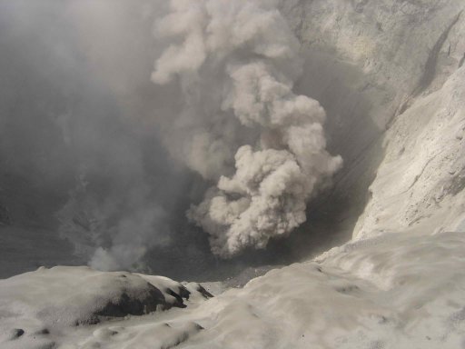
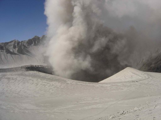
| Images from Guido Salas, Facultad de Geologia y Geofisica, Universidad Nacional de San Agustin, Arequipa, Peru |
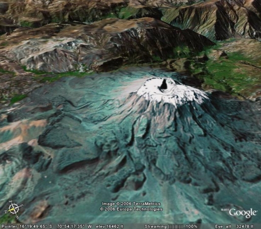
 Google Earth Picture of Ubinas |
-
Additional Sources of Information:
CVZ Volcano Zone
Bullard, F.M. 1962. Volcanoes of southern Peru. Bull. Volcanol. XXIV: 443-453.
de Silva S.L., & Francis, P.W., 1990. Active and potentially active volcanoes of southern Peru - observations using Landsat Thematic Mapper and Space Shuttle imagery. Bull. Volcanol. 52, 286-301.
Hantke, G., & Parodi, A., 1966. Catalogue of the active volcanoes of the world; Part XIX, Colombia, Ecuador & Peru, I.A.V.C.E.I. Naples, Italy, 73pp.
McLelland, L., Simkin, T., Summers, M., Nielsen, E., and Stein, T.C., (eds.) 1989. Global Volcanism 1975-1985. National Museum of Natural History. Prentice-Hall Inc., New Jersey, pp655.
Smithsonian Institution's Global Volcanism Program