Halmahera Arc Volcanoes, Indonesia

A view of the Halmahera volcanic arc looking south. From the nearest to farthest: Ibu, Gamkonora, Todoko-ranu, Jailolo, Gamalama, Tidore.
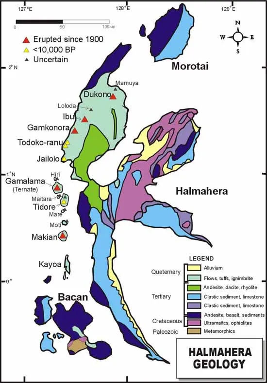
Geologic map of Halmahera, Indonesia.
Dukono Gamalama, Ternate Island
Jailolo Kiematabu, Tidore Island
Sources of Information:
Carlile, J.C., Davey, G.R., Kadir, I., Langmead, R.P., and Rafferty, W.J., 1998, Discovery and exploration of the Gosowong epithermal gold deposit, Halmahera, Indonesia: Journal of Geochemical Exploration, v. 60, p. 207-227.
Kusumadinata, K., 1977, Data on the Dukono volcano; Berita Direktorat Geologi, v. 9, no. 16, p. 183.
McClelland, L., Simkin, T., Summers, M., Nielsen, E., and Stein, T.C., 1989, Global Volcanism 1975-1985: Englewood Cliffs, New Jersey, Prentice Hall, 655 p.
Simkin, T., and Siebert, L., 1994, Volcanoes of the World: Geoscience Press, Tucson, Arizona, 349 p.