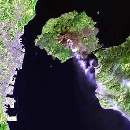
A subset of a Landsat 7 image showing a mildly erupting Sakurajima Volcano near Kagoshima, Japan, taken February 13th, 2000. Landsat spectral bands 7.5 and 2 were used for red, green, and blue, providing a good view of the geological features as well as emphasizing the extents of the nearby cities.

Since 1955 Sakura-jima volcano has erupted 100-200 times each year. Here is a sequence of four photos showing a typical vulcanian eruption.


Sakurajima, a stratovolcano on the the island of Kyushu, is one of the most active volcanoes on Earth. Since it's first recorded eruption in A.D. 708, Sakurajima has been in nearly constant eruption. Most eruptions are Stombolian in character and effect only the summit of the volcano. However, deaths were caused by pyroclastic flows, tsunami, lava, and tephra during large eruptions in 1471-1476, 1779, and 1781. Earthquakes prior to the large eruption in 1914 did cause numerous deaths but provided warning of the impending eruption and the volcano was evacuated. The current eruptive activity began in 1955.


In 1994, there were 126 explosive eruptions at Sakurajima. People living near the volcano must contend with ashfall from some of the larger explosions. Photograph copyrighted and provided by Steve O'Meara of Volcano Watch International. Activity at Sakurajima continues. Eruptions occur each month and many are explosive. On May 23, 1995, an explosive eruption sent a plume of ash 8,200 feet (2,500 m) above the summit crater.

Eruption of Sakurajima, May 26, 1994.
More Information on Sakurajima
- Working on Sakurijima
- Sakurajima is a Decade Volcano and monitored by the Sakurajima Volcanological Observatory at Kyoto University.
- Additional photos of Sakurajima
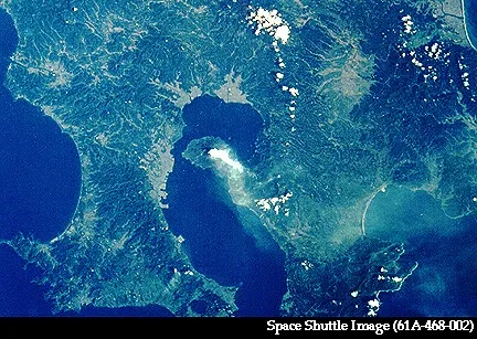
- Kyushu Map
Sources of Information:
Volcanoes of the World by Tom Simkin and Lee Siebert Bulletin of Global Volcanism, 1995, v. 20, no. 5, p. 9.