Pisgah is to the north and Sunshine Cone to the south.
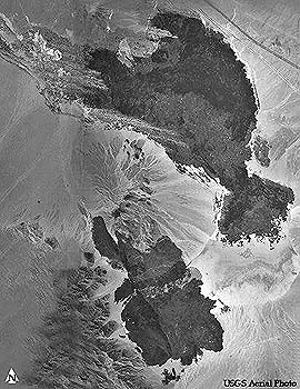
Pisgah is a lava field in the Eastern Mojave Desert, California that consists of numerous thin flows that extend from the vent about 11 miles (~18km) to the west and 5 miles (8 km) to the southeast. Pisgah lava field is predominantly pahoehoe with some aa. Because of the fresh nature of these flows Pisgah's activity is considered to have been recent.
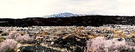
Click on the above image for a panoramic view of the area.
Pisgah Crater is the youngest vent and is a cinder cone that dominates the surrounding landscape with a height of 321 ft. (98m) and a base width of 1,600 ft.(488m). It is presently being mined for aggregate.

Click on the above image for a panoramic view of the area.
Pisgah is just east of Barstow, C.A. off National Trails Highway (old route 66) Exit Hector Road (off the Interstate 40) then go east on National Trails Highway for about 2 miles and its on your right side.
Source Information:
Wood, Charles A., Jurgen Kienle, eds; 1990, Eileen Theilig in Volcanoes of North America: United States and Canada, Cambridge University Press, p.242-243