Image
Guagua Pichincha is a stratovolcano. Its caldera is 1.6 miles (2.6 km) in diameter. Pichincha has erupted 25 times. Its last recorded eruptive activity was in 1993. Quito, the Capital of Ecuador, is located in the foothills of the volcano. The city has been devastated several times by eruptions of Guagua Pichincha. The worst of these events occurred in 1660, when over 10 inches (25 cm) of ash and volcanic fragments covered the city.
Image

Image

Image

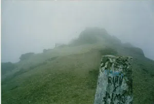
Above photos by Christian C. Johnson.
Image

The crater floor of Gua Gua Pichincha on June 7, 1987.
Sources of Information:
Marocco, Rene, "El Contexto Geologico Del Espacio Fisico Ecuatoriano," Estudios De Geografia, Volumen 6, Corporacion Editora Nacional, Colegio de Geografos del Ecuador, Quito, 1994, 113 pp.
Latitude (DD)
-0.17
Longitude (dd)
-78.60
Elevation (m)
4784
Country
Ecuador