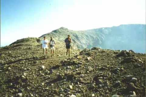
Traversing the Mt. Gamalama crater on Ternate Island. Noxious volcanic gases being emitted from the crater.
Gamalama (also called Peak of Ternate) is a stratovolcano with multiple craters and crater lakes. Gamalama forms an island about 11 km in diameter. Small to moderate explosive eruptions are frequent with 70 known eruptions since 1538. Several eruptions have produced lava flows or mudflows. Six eruptions have caused fatalities. Glowing ash and rock killed 30-40 slaves during the 1771-1772 eruption. In 1773, several people drowned as overloaded boats fled from an eruption. During a maar-forming eruption in 1775, about 1,300 people were killed by pyroclastic flows or surges. In 1838, four sulfur collectors died in the crater. In 1871, a block fell on and killed a man. Five people were killed and five injured at Gamalama in 1962. The most recent eruption was in 1993.
Since 1538, Gamalama has erupted explosively at least 57 times. The most recent eruption was in 1993 and lasted about 2 weeks. The eruptions are commonly moderate to moderately large (VEI=2-3). Six eruptions have caused fatalities. In 1775, a maar -forming eruption on the north coast of the volcano produced a base surge that killed 141 people. In all, about 1,300 people died in this eruption. Gamalama erupted in October of 1994, creating a 1,000 foot (300 m) tall plume and depositing a thin layer of ash on nearby villages. No one was injured.
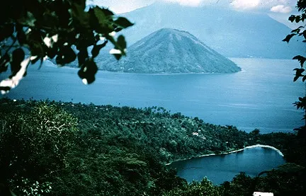
Laguna maar on Gamalama. View is to the south.
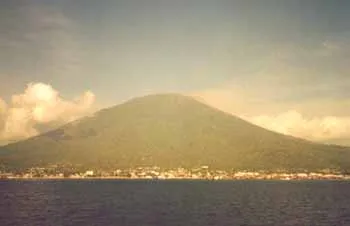
Mt. Gamalama rising above the city of Ternate. A small eruption plume is visible, causing hazy conditions in the area. View from the south.

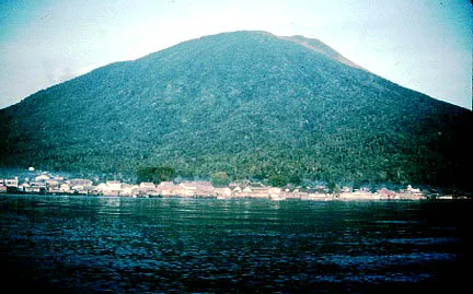
Mt. Gamalama viewed from the east on Halmahera Island.

Smoking Mt. Gamalama as viewed from the east side of Ternate Island at the airport. The edges of the two old craters can be seen as small lumps to the left of the active cone.
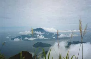
Mt. Gamalama on Ternate Island as viewed from the dormant summit crater of neighboring Tidore (Mt. Kiemtabu). The small volcanoic island between Tidore and Ternate is Maitara.

The cloud capped summit of Mt. Gamalama on Ternate Island. A relatively recent lava flow can be seen fingering into the sea on the north side of the island.
Source of Information:
Bronto, S., Hadisantono, R.D., Lockwood, J.P., 1982, Geologic map of Gamalama volcano, Ternate, North Maluku: Volc. Surv. Indonesia: 1:25,000 geol map and text.
Lockwood, J.P., Melson, W.G., Lanphere, M.A., and bronto, S., 1981, Petrology and eruptive characteristics of Gamalama volcano, Ternate Island, Indonesia (abs): IAVCEI, Tokyo Mtg. Abstracts, p. 207.
McClelland, L., Simkin, T., Summers, M., Nielsen, E., and Stein, T.C., 1989, Global Volcanism 1975-1985: Englewood Cliffs, New Jersey, Prentice Hall, 655 p.
Simkin, T., and Siebert, L., 1994, Volcanoes of the World: Geoscience Press, Tucson, Arizona, 349 p.
Smithsonian Institution's Global Volcanism Network, 1995, Summary of Recent Activity: Bulletin of Volcanology, v. 57, p. 73-75.