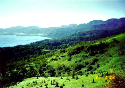
Photograph of Akan, Kutcharo, and Mashu calderas. North is towards the top-left corner.

Location map for the Kutcharo and Mashu calderas from Newhall and Dzurisin (1988).
Kutcharo (also called Kuttyaro) is a caldera about 20 by 26 km in diameter. The caldera formed about 30,000 years ago and is now partially filled by Kutcharo Lake. Nakajima, a post-caldera stratovolcano, forms an island in the lake. A younger volcanic complex, called Atosanupuri, fills the eastern half of the caldera. Atosanupuri consists of a stratovolcano and a cluster of lava domes. The most recent eruption at Atosanupuri was dated at 1000AD using tephrochronology. Mashu stratovolcano is younger than Kutcharo caldera and grew on the east rim of the caldera. A caldera eruption at Mashu about 7,000 years ago truncated the cone, making the volcano resemble Crater Lake in Oregon.

View along the rim of Kutcharo Caldera. Photograph courtesy of and copyrighted by Mike Lyvers.

View across Lake Kutcharo to Nakajima island (middle ground) and the numerous domes of Atosanupuri (background). Photograph courtesy of and copyrighted by Mike Lyvers.
Sources of Information:
Newhall, C.G., and Dzurisin, D., 1988, Historical unrest at large calderas of the world: U.S. Geological Survey Bulletin 1855, 1108 p.
Simkin, T., and Siebert, L., 1994, Volcanoes of the World: Geoscience Press, Tucson, Arizona, 349 p.